By Alissa Greenberg,Special to SFGATE Nov 1, 2023 (SFGate.com)
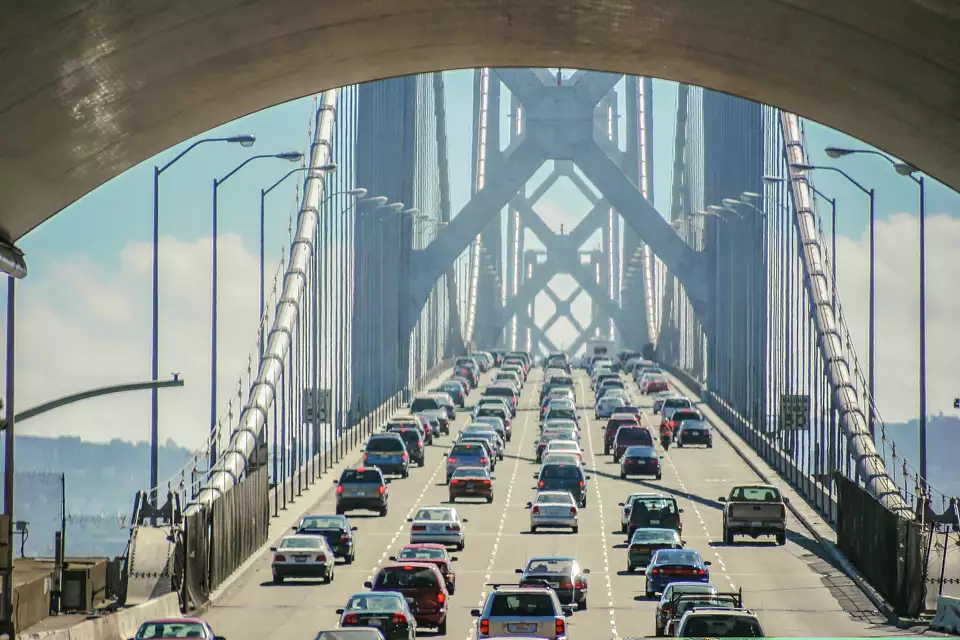
A view of traffic on the Bay Bridge, the 8.4-mile structure that connects the East Bay and San Francisco, Calif.MasaoTaira/Getty Images/iStockphoto
Developing a metropolitan area around a giant body of water has its advantages — beautiful views, sea breezes, lots of great nature — but it also presents impracticalities. One example: the trip from the East Bay into San Francisco. The trip is often a traffic-choked, expensive pain if you’re driving, or can be a delayed, crowded annoyance if you’re taking BART.
Since 2013, however, there’s been a third option: the Bay Bridge Trail. You can’t walk or bike across the full span of the Bay Bridge just yet (we’ll get to that later), but the journey from Oakland to Yerba Buena Island sure is beautiful. Keep reading for everything you need to know about walking and biking across this remarkable piece of urban infrastructure.
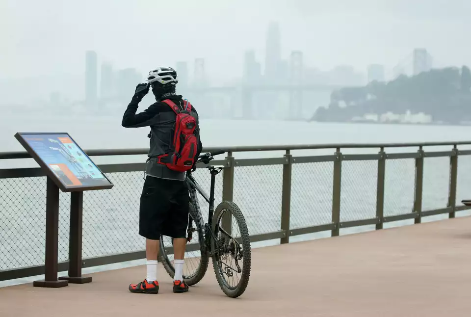
A cyclist reads one of several interpretive signs at Judge John Sutter Regional Shoreline in Oakland, Calif. The shoreline park, which opened in 2020, is located at the base of the Bay Bridge and utilizes two concrete platforms from the original bridge as the base of the observation pier. San Francisco Chronicle/Hearst N/San Francisco Chronicle via Getty Images
Where exactly is the Bay Bridge Trail?
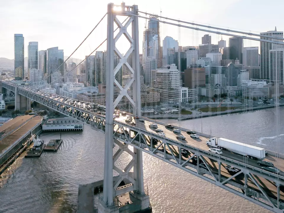
First of all, let’s start by making sure we’re on the same page about what exactly it is we’re talking about. This is confusing, but bear with me: the Bay Bridge Trail is part of the San Francisco Bay Trail but it is not part of the Bay Area Ridge Trail. Furthermore, don’t confuse the Bay Bridge with the Golden Gate Bridge. The Bay Bridge spans from Oakland to San Francisco’s downtown. Thanks to the Bay Bridge Trail, you can pedal over the eastern span of the bridge from Oakland to Yerba Buena Island, just over half the bridge’s length.
What can you see from the Bay Bridge Trail?
You can kick off your trip at Oakland’s Judge John Sutter Regional Shoreline. The park, which opened in October 2020, offers gorgeous views of the Bay from a pier built on pilings from the original Bay Bridge.
The vistas are even more unique once you get on the Bay Bridge Trail itself. You’ll be treated to a mix of coastal panoramas and close-up details of some remarkable bridge architecture. Be sure to stop at a few of the seven “belvederes,” observation platforms for walkers and cyclists to pause and take in the city from afar and the water far below.
Once you get to Yerba Buena Island, your first stop is Bimla Rhinehart Vista Point. Similar to its park mate across the water, the park was built on leftover piers from the old bridge and incorporates salvaged trusses into its design. Since it sits under the Bay Bridge itself, this is one of the best spots to appreciate the enormity of this piece of engineering. While you catch your breath, you can also check out the nearby historic Torpedo Storehouse, the last remnant of the Army base that once stood here. (Be prepared for the fact that there’s a steep hill between the bridge and the vista point, since you’re coming down to sea level. If you’re biking, that means lots of braking on the way down and tough pedaling on the way up.)
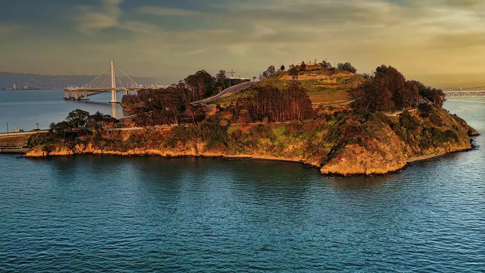

After you’re suitably refreshed, make your way over to Treasure Island, Yerba Buena’s flatter, manmade cousin. The island has long been famous for its jaw-dropping views of the San Francisco skyline. (For one highlight, follow the Treasure Island Perimeter Path along the north side to Treasure Island View Point, although you can’t really go wrong with the views from anywhere along the shore here.) The area is entering a period of intense development, meaning there will soon be much more to see and do here; poking around the blossoming public art scene is a fun way to explore more of what’s to come. If you get hungry, Mersea Restaurant serves a killer pulled pork sandwich and golden hour cocktails to slake your thirst before the ride home.
BEST OF SFGATE
Travel | This middle-of-nowhere Calif. diner was James Dean’s last stop
Food | ‘Corporate greed’ nearly killed San Francisco icon Swensen’s
Local | What happened to the haunted house on Fisherman’s Wharf?
History | The unbelievable true story of a body found in a Calif. funhouse
How to get to the Bay Bridge Trail
The Bay Bridge Trail is open daily from 6 a.m. to 9 p.m. The 15.5-foot-wide path is divided into one lane in each direction for bicyclists and an outside lane for pedestrians.
Five hour parking is available at the lot at 210 Burma Road in Oakland at the Bridge Yard. Bikers arriving by BART should ride west down 40th Street from the MacArthur BART station, continuing on as 40th turns into Shellmound. You’ll find the trailhead across the street from IKEA in Emeryville. If you’re coming on foot, take the Emery-Go-Round Powell shuttle or AC Transit Line 26, getting off at the IKEA stop. Access is slightly more complicated but also viable from 19th Street BART, via a short bike ride on Broadway, West Grand Avenue and Maritime.
Travelers wanting to make this trip from San Francisco will unfortunately need to take the bus all the way across the bridge first. To do so, you can take the AC Transit Transbay NL or O bus from the Salesforce Transit Center and get off at the Toll Plaza stop on the Bay Bridge. Then you can bike out to the island and back, or take the ferry onward to downtown (see below).
Tip: Don’t forget that AC Transit has bike racks on the front of its busses. Ask your driver when you get on.

Is the Bay Bridge Trail complete?
In all this talk about the Bay Bridge Trail, you probably noticed something missing: there’s a path from Oakland to the Bay’s islands, but there’s no way to bike the rest of the way across to San Francisco — at least not yet.
A proposed Bay Skyway would solve that problem, connecting Yerba Buena and Treasure Islands to San Francisco via a path that would end at Essex Street downtown. State and federal environmental analyses for the skyway are projected to finish in 2024, with the hope that (with funding secured) the path could open in 2030. Earthquake safety, maintenance access, boat clearance and possible strong winds all present obstacles to successful design and execution of the skyway. But with estimated costs in the hundreds of millions of dollars, funding remains the project’s biggest hurtle.
The good news: Even without this addition, you’ll soon be able to finish your bike ride across the Bay with an electric ferry ride from Treasure Island to San Francisco’s Mission Bay starting in 2025. Even now, there’s a limited interim service ferry that currently runs this route. The Bay Bridge Trail might not be truly commutable yet, but it’s perfect for a sunny day out on the Bay.
This story was edited by Hearst Newspapers Managing Editor Kristina Moy; you can contact her at kristina.moy@hearst.com.
Nov 1, 2023
Alissa Greenberg is a freelance writer for Hearst and an independent journalist with home bases in Berkeley, California and Boston, Massachusetts. Her work has appeared in print and online in The San Francisco Chronicle, The Washington Post, The Atlantic, The New Yorker, Smithsonian, and elsewhere. Follow her on Twitter, Instagram, or Facebook.